Maps
Choose up to 4 products to compare
Products 49-96 of 102
Show
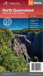
Item #: 9321438002116 -
North Queensland Map (11th edition) - this is the ideal North Queensland map for discovering the many destinations between Mackay and The Tip. The mapping is at a touring scale of 1:750,000, with terrain shading and touring symbols giving an accurate and informative overview of the region. There is a detailed inset map for Mackay and the Whitsundays and another for the entire coastal strip between Townsville and Cooktown. There is also tourist information on the popular coastal strip with...
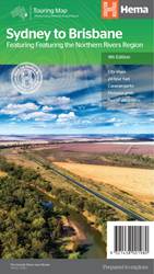
Item #: 9321438001980 -
Sydney to Brisbane Map (13th edition) - a city to city map designed for the journey from Sydney to Brisbane via the Pacific and New England Highways (1:1,000,000), with tourist information on towns and regions within the trip on the opposite side. Features: City maps 24-hour fuel Camping areas Distance grids Tourist attractions Roadside rest areas Scale: 1:1,900,000 Folded size (WxHxD): 140mm x 250mm x 3mm Flat size (WxH): 700mm x 1000mm ...
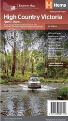
Item #: 9321438001720 -
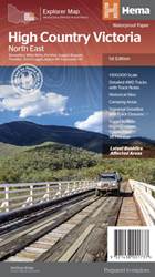
This map is part of Hema's new Victorian High Country Map Series and covers the North Western Alps Area including Hotham, Wangaratta and surrounds. Printed on durable waterproof paper, this map features Hema's iconic mapping and extensive points of interest. Featuring roads and 4WD tracks field-checked by the Hema Map Patrol for superior accuracy. It combines Hema’s entire database of roads and 4WD tracks with touring points of interest and topographic information. Also included are seasonal...
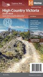
Item #: 9321438001751 -
This map is part of Hema's new Victorian High Country Map Series and covers the Southern Ranges Areas including Baw Baw to Dargo and surrounds. Printed on durable waterproof paper, this map features Hema's iconic mapping and extensive points of interest. Featuring roads and 4WD tracks field-checked by the Hema Map Patrol for superior accuracy. It combines Hema’s entire database of roads and 4WD tracks with touring points of interest and topographic information. Also included are seasonal track...
Item #: 9321438001744 -
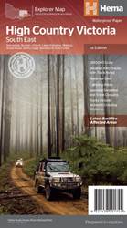
This map is part of Hema's new Victorian High Country Map Series and covers the Southern Lowlands and Lakes Areas including Gippsland and Snowy River National Park. Printed on durable waterproof paper, this map features Hema's iconic mapping and extensive points of interest. Featuring roads and 4WD tracks field-checked by the Hema Map Patrol for superior accuracy. It combines Hema’s entire database of roads and 4WD tracks with touring points of interest and topographic information. Also...
Item #: 9321438001737 -
This map is part of Hema's new Victorian High Country Map Series and covers the Northern Borderlands Area from Omeo to Jindabyne. Printed on durable waterproof paper, this map features Hema's iconic mapping and extensive points of interest. Featuring roads and 4WD tracks field-checked by the Hema Map Patrol for superior accuracy. It combines Hema’s entire database of roads and 4WD tracks with touring points of interest and topographic information. Also included are seasonal track closures,...
Item #: 9321438001638 -
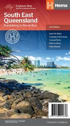
A regional map of South East Queensland (1:500,000) that stretches from the New South Wales-Queensland border to past Bundaberg, with maps of the Brisbane Region (1:300,000), Brisbane City and the Gold Coast on the opposite side. Features: Inset Maps (Brisbane City and Gold Coast) Camping and rest areas Caravan Parks Fuel Locations National parks Rail and ferry network maps Brisbane region suburb and location index Scale: 1:500,000 Edition:2Publication Date:01/09/2014 ...
Item #: 9321438002109 -
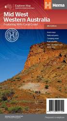
A regional map of Mid West Western Australia that covers from Cape Range National Park south to Mandurah and as far as Kalgoorlie at a scale of 1:1,250,000 that has camping areas, national parks, fuel supplies and facility symbols marked on the map. On the reverse is region-specific touring information for Wildflower country, Goldfields, Batavia Coast, Geraldton to Kalbarri, Gascoyne and the Outback Coast, Carnarvon and the Blowhole Coast as well as the Great Eastern Highway, with detailed...
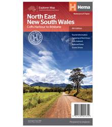
Item #: 9321438001652 -
A regional map of North East New South Wales (1:375,000) that is the perfect companion for touring through North East New South Wales (NSW). The map features information on the major touring routes through the region including the Summerland Way, Bruxner Highway, Waterfall Way and Gwydir Highway, as well as major tourist attractions along both the Pacific Highway and the New England Highway. Also included are listed national parks within the region, contact information and events. Key...
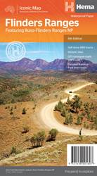
Item #: 9321438001607 -
A waterproof map of the Flinders Ranges with inset national park maps of Flinders Ranges National Park and Vulkathunha-Gammon Ranges National Park. Visitor information for both the national parks, the Leigh Creek region and the Blinman region make trip planning and navigation simple, with accompanying tourist information including self-drive treks, historic sites, necessary contact details and listed national parks and reserves. Key features: GPS surveyed roads and tracks Self-drive 4WD tracks...
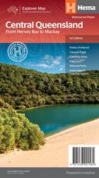
Item #: 9321438001584 -
A regional map of central Queensland (1:1,000,000) that stretches inland past Jericho and from Maryborough in the south to Mackay in the north. On the opposite side is tourist information on the region, as well as inset maps of Mackay, the Capricorn Coast, Gladstone, Bundaberg, Rockhampton, and the Gemfields. Accompanying each inset map are photos as well as background and travel information on the region that help for planning and touring.Features: Inset town and city mapsNational...
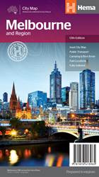
Item #: 9781876413965 -
The Melbourne and Region map features a primary map of Greater Melbourne (1:115,000) that includes highways, major roads and local streets, as well as 24-hour fuel, parks and caravan parks. On the reverse is a Melbourne CBD map with accommodation, shopping and other places of interest pinpointed, along with train and tram network maps and a Melbourne Region map.The cosmopolitan capital of Victoria, Melbourne is a city of distinct districts: each with its own particular appeal. For a different...

Item #: 9781925625158 -
Hema's Adelaide and Region Map features a primary map of greater Adelaide at a 1:80,000 scale that includes major highways, regional and local roads, as well as 24-hour fuel stops, caravan parks and other Points of Interest. On the reverse side is a detailed map of the Adelaide city centre, featuring the best in accommodation, restaurants and theatres. Also included is a Barossa Valley map and a rail network map. This is the perfect map for planning a weekend escape to Adelaide and navigating...
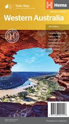
Item #: 9321438001553 -
A state touring map of Western Australia (WA) featuring: Camping and rest areas Caravan parks Fuel locations Information centres Desert tracks Full index Waterproof paper Folded size (WxHxD): 140mm x 250mm x 3mm Flat size (WxH): 700mm x 1000mm Scale: 1:2500000 On the reverse side of the maps are the CBD and through road maps of Perth, plus inset maps of Leeuwin-Naturaliste National Park, Cape Range National Park, Nambung National Park, Francois Peron National Park, Purnululu National Park,...
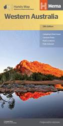
Item #: 9321438001560 -
A compact map of Western Australia for touring throughout the state with a distance grid and index for planning and reference. Marked on the mapping are highways, major and minor roads, camping and rest areas, 24-hour fuel, information centres, picnic areas, caravan parks and lookouts. Features: Camping areasCaravan ParksFully indexedEasy to useUnfolded Size (WxH) - 500mm X 875mmCover Size (WxHxD) - 125mm x 250mm x 3mm Edition:13Publication Date:01/11/19 ...
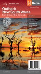
Item #: 9321438001577 -
A regional map of outback NSW (1:1,100,000) that ranges from Tamworth in the east to Broken Hill in the west, as well as from Wagga Wagga in the south to past the Queensland border in the north. On the opposite side is extensive information on numerous regions, including visitor, historical and background information. Covered regions include the Broken Hill region, Corner Country, east of Tibooburra, the White Cliffs region, Cobar and surrounds, around Back o'Bourke, Lightning ridge and...
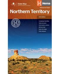
Item #: 9321438001508 -
A touring map of the Northern Territory that has camping and rest areas, 24hour fuel and points of interest marked on the mapping. On the reverse are CBD maps of Darwin and Alice Springs, a map of the greater Darwin region and maps of Yulara, Uluru and Kata Tjuta with walking tracks, points of interest and accommodation included. For trip planning there is a national park matrix and contact details for information centres. PRODUCT FEATURES GPS surveyed roads and tracks Fuel stops 4WD tracks...
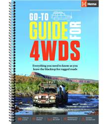
Item #: 9321438001522 -
A four-wheel drive is your ticket to the seldom-seen spectacles of Australia’s lesser-trodden paths. Join Hema, as we provide the reader with a broad foundation of understanding, on which to begin their own 4WD adventure. This informative guide, produced from the experience of the Hema Map Patrol's thousands of hours of four-wheel driving experience, covers: Key Features: Types of four wheel drive vehicles Gear and modifications Technical Tips Maintenance Terrain and driving Off-road recovery...
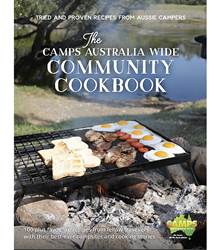
Item #: 9780994532701 -
From the creators of CAMPS 10 and Caravan Parks 5, Australia’s favourite RV travel guides, the Camps Australia Wide Community Cookbook is full of tried and true recipes generously provided by the CAMPS community. Features: Campers best ever campsites and caravan parks Their 'must see and do' Aussie recommendations ‘Happy hour worthy’ camp cooking memories and stories Versatile recipes for camp oven, BBQ, gas stoves, ovens, microwaves, thermal and slow cookers Salads, stews,...
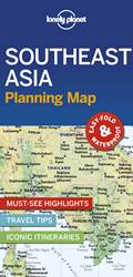
Item #: 9781788686082 -
Durable and waterproof, with a handy slipcase and an easy-fold format, Lonely Planet’s Southeast Asia Planning Map helps you explore with ease. Get more from your map and your trip with images and information about top attractions, itinerary suggestions and themed lists. With this easy-to-use, full-colour map in your back pocket, you can truly get to the heart of Southeast Asia – so begin your journey now! Easy-fold format Handy slipcase Full colour and easy to use Beautiful imagery Tailored...
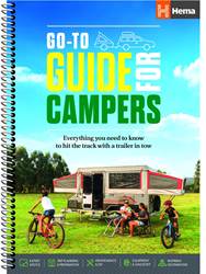
Item #: 9781925625882 -
Camper trailer touring is one of the most liberating ways to travel, allowing adventurous souls to push into some of Australia’s most remote and picturesque locations.Produced in collaboration with Camper Trailer Australia, the Go-To Guide for Campers covers everything you’ll need to know, presented in an easy-to-read format with plenty of pictures and, of course, a handful of Hema maps. The Go-To Guide covers: Trip planningPreparationEquipment & GadgetryMaintenance & DIYSafety &...
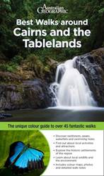
Item #: 9781922131539 -
Best Walks around Cairns & the Tablelands includes over 45 north Queensland walks from Cooktown down to Hinchinbrook Island. Each walk specifies the distance, the total ascent and descent (if appropriate), the grade and the estimated duration and is accompanied by an accurate full-colour map. Snippets about Queensland’s history and wildlife add colour and interest to the walking experience. Families will enjoy information regarding child-friendly walks, and how to explore the bush safely...
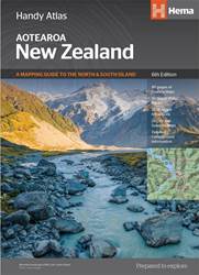
Item #: 9781925625042 -
Tour the land of the long white cloud with New Zealand’s clearest and most up-to-date maps – the hard work's all taken care of. There's something for every kind of traveller among these meticulously crafted maps and guides, with more than 1500 motorhome parks, adventure activity locations, camping grounds and additional city and national park maps. All presented in an easy to read, easy to store format – finally putting an end to back-road map rage. With so much to see and do you'll be glad to...
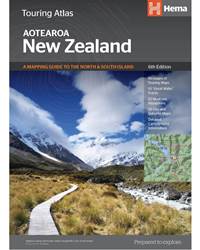
Item #: 9781925625035 -
Tour the land of the long white cloud with New Zealand’s clearest and most up-to-date maps – the hard work's all taken care of. There's something for every kind of traveller among these meticulously crafted maps and guides, with more than 1500 motorhome parks, adventure activity locations, camping grounds and additional city and national park maps. All presented in an easy to read, easy to store format – finally putting an end to back-road map rage. With so much to see and do you'll be...
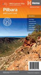
Item #: 9781925625752 -
This regional waterproof map of the Pilbara and Coral Coast is ideal for discovering the northern reaches of Western Australia. The main map covers the diverse marine attractions around Shark Bay, François Peron National Park and the Ningaloo Reef. It also stretches to the gorges of Karijini, lush habitats of Millstream Chichester National Park and the magnificent Marble Bar. It also features additional information relating to permits, useful contacts and historical context surrounding some of...
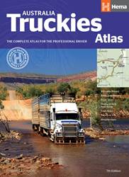
Item #: 9781925625776 -
The Australia Truckies Atlas is tailored to the professional driver, with a complete Hema Road Atlas and necessary truck-related features to help drivers navigate all over Australia. Each map displays B-Double and road train routes as well as truck stops, heavy vehicle rest areas, weighbridges and low-clearance bridges, which are also listed in a directory with necessary information and map references. There are 112 town maps to complement the Australia-wide atlas maps, with truck routes,...
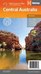
Item #: 9781925625738 -
This waterproof map of the Central Australia region is ideal for discovering some of Australia's most iconic landscapes. The main map covers the area around Alice Springs, including Uluru, Kata Tjuta, West MacDonnell Range, as well as the Simpson Desert and popular tracks such as the Canning Stock Route. It also features additional information relating to permits, useful contacts and historical context surrounding some of the area's most popular tourist destinations. PRODUCT FEATURES GPS...
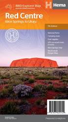
Item #: 9781925625745 -
This regional waterproof map of the Red Centre is ideal for discovering the quintessentially Australian landscape of at the heat of the country. The main map covers the area around Alice Springs, including Uluru, Kata Tjuta, West MacDonnell Range and Watarrka National Park. It also features additional information relating to permits, useful contacts and historical context surrounding some of the area's most popular tourist destinations. PRODUCT FEATURES GPS surveyed roads and tracksFuel...
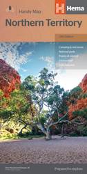
Item #: 9781925625684 -
A map of the Northern Territory that has camping and rest areas, 24hour fuel and points of interest marked on the mapping. On the reverse are CBD maps of Darwin and Alice Springs, a map of the greater Darwin region and maps of Yulara, Uluru and Kata Tjuta with walking tracks, points of interest and accommodation included. For trip planning there is a national park matrix and contact details for information centres. PRODUCT FEATURES GPS surveyed roads and tracksFuel stops4WD tracksCamping...
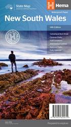
Item #: 9781925625615 -
New South Wales State Map (14th Edition) This state map of New South Wales (NSW) is at a scale of 1:1,500,00 and includes national parks, points of interest, 24-hour fuel in addition to camping and rest areas. On the reverse side are CBD and through-road maps of Sydney and Canberra, as well as the Sydney regional area. There is a full index included, as well as all national park information. Points of interest24-hour fuelNational parksCamping areasRest areasFully indexed ...
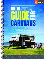
Item #: 9781925625622 -
From windswept grey nomads to sun kissed newly-weds, Hema's Go-To Guide for Caravans is a vital companion for every kind of caravan-hauling holiday maker. Everything the reader will need to know is presented in an easy-to-read format, with plenty of info-graphics and Hema maps, and advice from an extensive network of industry-leading experts. The Go-To Guide covers: Trip planningPreparationEquipment & GadgetryMaintenance & DIYSafety & SecurityFood and FrivolitiesInspiring Destinations ...
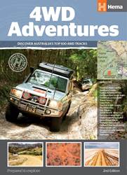
Item #: 9781876413569 -
Discover Australia’s Top 100 4WD tracks using this guide as your ultimate off-road adventure tool. Each page features colourful, glossy imagery and detailed tracks personally mapped out and driven by the Hema Map Patrol and our team of experts, for the most up-to-date information across 19 different regions of Australia. With the 4WD Adventures guide, you can expect to have a reliable source of knowledge at your fingertips, turning your 4WD trip into a reality. Features: 100 4WD trips from 19...
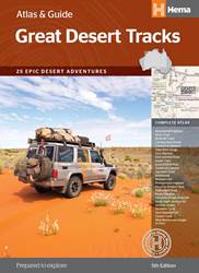
Item #: 9781876413637 -
For over 20 years, Hema's Map Patrol has been mapping the interior of Australia. In this comprehensive guide to traversing Australia's desert regions, Hema takes you into the arid heart of Australia. Whether you are a desert lover, or just looking to tackle some of Australia's favourite 4WD destinations, this informative guide is an indispensable companion to those tackling Australia's great desert tracks. This edition includes handy track profiles showing elevations and distances as well as...
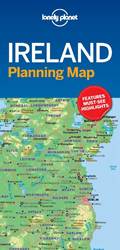
Item #: 9781787014541 -
Durable and waterproof, with a handy slipcase and easy-fold format, Lonely Planet’s Ireland Planning Map helps you get around with ease.Get more from your map and your trip with images and information about top country attractions, itinerary suggestions, a transport guide, planning information, themed lists and practical travel tips.With this easy-to-use, full-colour map in your back pocket, you can truly get to the heart of Ireland. Durable and waterproof Easy-fold format and convenient size...
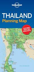
Item #: 9781787014558 -
Durable and waterproof, with a handy slipcase and easy-fold format, Lonely Planet’s Thailand Planning Map helps you get around with ease.Get more from your map and your trip with images and information about top country attractions, itinerary suggestions, a transport guide, planning information, themed lists and practical travel tips.With this easy-to-use, full-colour map in your back pocket, you can truly get to the heart of Thailand. Durable and waterproof Easy-fold format and convenient...
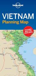
Item #: 9781787014565 -
Durable and waterproof, with a handy slipcase and easy-fold format, Lonely Planet’s Vietnam Planning Map helps you get around with ease. Get more from your map and your trip with images and information about top country attractions, itinerary suggestions, a transport guide, planning information, themed lists and practical travel tips. With this easy-to-use, full-colour map in your back pocket, you can truly get to the heart of Vietnam. Durable and waterproof Easy-fold format and convenient...
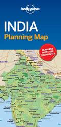
Item #: 9781787014572 -
Lonely Planet Best of India is your passport to the most relevant, up-to-date advice on what to see and skip, and what hidden discoveries await you. Gaze at the iconic Taj Mahal, ride a camel through a magical desert scene in Jaisalmer, or hit the famous beaches of Goa; all with your trusted travel companion. Discover the best of India and begin your journey now!Inside Lonely Planet Best of India:Full-colour maps and images throughoutHighlights and itineraries help you tailor your trip to your...
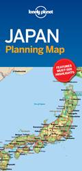
Item #: 9781787014510 -
Durable and waterproof, with a handy slipcase and easy-fold format, Lonely Planet’s Japan Planning Map helps you get around with ease.Get more from your map and your trip with images and information about top country attractions, itinerary suggestions, a transport guide, planning information, themed lists and practical travel tips.With this easy-to-use, full-colour map in your back pocket, you can truly get to the heart of Japan. Durable and waterproof Easy-fold format and convenient size...
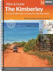
Item #: 9781876413644 -
The definitive guidebook for exploring Western Australia's Kimberley region, featuring the Top 10 4WD Trips written by Ron and Viv Moon, in combination with topographic atlas mapping for the region. This edition of Hema’s best-selling outdoor guidebook for discovering the Kimberley now features 20 atlas pages in a stunning new cartographic style. The guide now features the Top 10 4WD Trips for the Kimberley, which has been written by off-road legends Ron and Viv Moon. Also included is an...
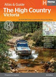
Item #: 9781876413149 -
The definitive guidebook for discovering the Victorian High Country, featuring the Top 30 4WD Trips written by Ron and Viv Moon, in combination with topographic atlas mapping for the region. This brand new edition of Hema’s best-selling outdoor guidebook for discovering the Victorian High Country now features 40 atlas pages at a large scale of 1:150 000 in a stunning new cartographic style. The guide now features the Top 30 4WD Trips for the High Country, which has been written by off-road...
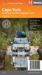
Item #: 9781925195149 -
Featuring the Old Telegraph TrackThis brand new edition of Hema’s best-selling Cape York map, on durable waterproof paper, features our latest mapping and points of interest in a new cartographic style. It now features new inset maps for the CREB Track and Rinyirru (Lakefield) National Park. It combines Hema’s entire database of roads and 4WD tracks with touring points of interest and topographic information. Also included are camping areas, national parks, accommodation and distances.Key...
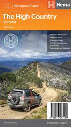
Item #: 9781876413125 -
This brand new edition of Hema’s best-selling High Country map, on durable waterproof paper, features our latest mapping and points of interest in a stunning new cartographic style. Featuring roads and 4WD tracks field-checked by the Hema Map Patrol for superior accuracy.It combines Hema’s entire database of roads and 4WD tracks with touring points of interest and topographic information. Also included are seasonal track closures, camping areas, old townsites, huts, accommodation and...
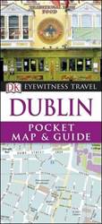
Item #: 9780241271674 -
Discover Dublin's essential sights with DK Eyewitness Pocket Map & Guide Dublin. Its compact format - about the size of a mobile phone - means you can slip it in your pocket on a day trip or short stay in Ireland's vibrant and friendly capital. DK Eyewitness Pocket Map & Guide Dublin showcases all the best things to do in Dublin, from visiting magnificent Dublin Castle to checking out the pubs in Temple Bar. Concise descriptions and practical information for the top sights in each area of the...
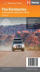
Item #: 9781876413705 -
A regional map of the Kimberley that features the iconic Gibb River Road. On the reverse are inset maps for Purnululu National Park, the Dampier Peninsula and the Parry Creek area. There is also extensive drive detail and trip coverage for the Gibb River Road.Waterproof paperDetailed 4WD tracksNational parksCamping areasGPS surveyed roads & tracksThis new edition of Hema’s best-selling Kimberley map features our latest mapping and points of interest in a stunning new cartographic style. It...
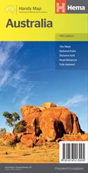
Item #: 9781876413095 -
The Australia Handy Map is a foldable, compact Australian map that is perfect as a journey planner or reference tool. It shows national parks and major road networks with distances for planning, along with major city CBD maps for Brisbane, Melbourne, Sydney, Canberra, Darwin, Adelaide, Perth and Hobart on the reverse side, as well as a distance chart and a place/name index for practical use. Features: Hema's iconic map of Australia Capital city maps National parks Road distances Indigenous...
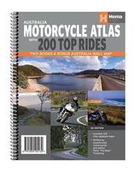
Item #: 9781925195132 -
The Hema Australia Motorcycle Atlas is split into two books, with volume 1 containing the 200 Top Rides while volume 2 is Hema's best-selling road atlas. 200 Top Rides written by Peter 'The Bear' ThoemingAustralia-wide road atlas mappingBest Touring Rides wall map It’s easy to find somewhere to ride with the Australia Motorcycle Atlas, which features Australia-wide city, state and regional mapping. Packaged in a protective plastic sleeve, the Australia Motorcycle Atlas is split into two books,...
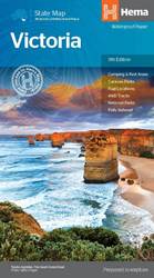
Item #: 9781865009834 -
A map of Victoria for touring throughout the state that has camping and rest areas, 24-hour fuel and points of interest marked on the mapping. On the reverse are CBD, surrounding region and through road maps of Melbourne in addition to maps of the Great Ocean Road and East Gippsland. Also included is a national park matrix and a list of accredited information centres within Victoria. 24-hour fuel National parks Camping and rest areas Fully indexed Points of interest Unfolded Size (WxH) - 100 x...
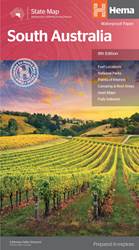
Item #: 9781865009865 -
A map of South Australia that is ideal for touring the state and its significant regions. On the reverse of the main South Australia map is an Adelaide CBD map with places of interest and accommodation listed, along with maps of Adelaide’s through roads, the Adelaide region, Flinders Ranges National Park and the Barossa Valley. National parks and information centres are listed also, combining with the various maps to form a comprehensive base of information to both plan and navigate your South...