Northern Territory
Choose up to 4 products to compare
Products 1-13 of 13
Show
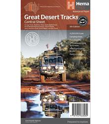
Item #: 9781922668080 -
Hema's Great Desert Tracks maps are essential for anyone travelling in the Australian outback. The mapping features roads and 4WD tracks field-checked by the Hema Map Patrol, Points of Interest for remote area travellers and touring information for learning more about the region and planning your journey. The Great Desert Tracks Central Sheet covers from Judbarra/Gregory National Park in the north to Ceduna in the south, and from Halls Creek in the west to Coober Pedy in the east. Marked...
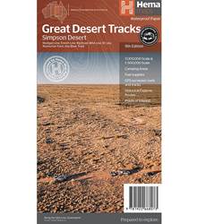
Item #: 9781922668073 -
Hema's Great Desert Tracks maps are essential for anyone travelling in the Australian outback. The mapping features roads and 4WD tracks field-checked by the Hema Map Patrol, Points of Interest for remote area travellers and touring information for learning more about the region and planning your journey. Discover the Simpson Desert with detailed mapping, relevant points of interest and essential touring information for the journey. One side of the map covers the desert at a scale of...
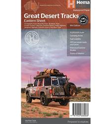
Item #: 9781922668066 -
Hema's Great Desert Tracks maps are essential for anyone travelling in the Australian outback. The mapping features roads and 4WD tracks field-checked by the Hema Map Patrol, Points of Interest for remote area travellers and touring information for learning more about the region and planning your journey. The Great Desert Tracks Eastern Sheet covers from Tennant Creek in the north to Port Pirie in the south, and from Cunamulla in the east to Alice Springs in the west. Marked on the mapping are...
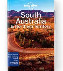
Item #: 9781787016514 -
Lonely Planet South Australia & Northern Territory is your passport to the most relevant, up-to-date advice on what to see and skip, and what hidden discoveries await you. Gaze at Uluru, explore the outback, and spot wildlife on Kangaroo Island; all with your trusted travel companion. Get to the heart of SA & NT and begin your journey now! Inside Lonely Planet South Australia & Northern Territory: Up-to-date information - all businesses were rechecked before publication to...
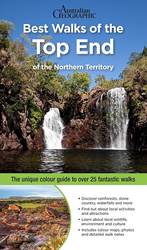
Item #: 9781925868333 -
Best Walks of the Top End includes over 25 walks in this much-loved region, well-known for its spectacular national parks: Kakadu, Nitmiluk and Litchfield. Each walk specifies the distance, the total ascent and descent (if appropriate), the grade and the estimated duration and is accompanied by an accurate full-colour map. Snippets about the Top Ends’ history, culture and wildlife add colour and interest to the walking experience. Families will enjoy information regarding child-friendly walks,...
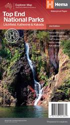
Item #: 9321438001669 -
A regional map that features Litchfield (1:160,000), Katherine Gorge and Kakadu (1:350,000) national parks. A Darwin region map is included (1:850,000) along with extensive tourist information for Darwin and the surrounding region, Arnhem Highway to Kakadu, Mary River, Stuart Highway to Katherine, Litchfield National Park, Katherine Gorge (Nitmiluk) National Park and Kakadu National Park. Also included are national park facility listings in addition to contact details for accommodation and...
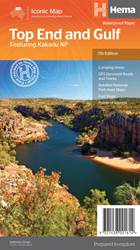
Item #: 9321438001614 -
This regional waterproof map of the Top End and Gulf is ideal for discovering the northern parts of Australia's NT by 4WD. It includes a main map of the Darwin region, Judbarra / Gregory National Park, Nhulunbuy, Keep River National Park and Boodjamulla (Lawn Hill) National Park. There is additional tourist information for Arnhem Land, the Roper River trek, Darwin region, Douglas-Daly district, Nature’s Way, Victoria Highway, Katherine Region and the Stuart Highway Region. Features: GPS...
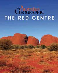
Item #: 9781925403831 -
Australian Geographic, in Association with Woodslane Press is delighted to introduce a new series of photographic souvenir guides to some of Australia's most beautiful and iconic places. The 64-page large format book full of vibrant photography, accompanied by a concise but fascinating commentary by some of Australia's most experienced travel writers. One of the first two books in the series, the Australian Geographic Book of the Red Centre is an indispensable reminder and souvenir for...
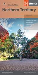
Item #: 9321438001508 -
A touring map of the Northern Territory that has camping and rest areas, 24hour fuel and points of interest marked on the mapping. On the reverse are CBD maps of Darwin and Alice Springs, a map of the greater Darwin region and maps of Yulara, Uluru and Kata Tjuta with walking tracks, points of interest and accommodation included. For trip planning there is a national park matrix and contact details for information centres. PRODUCT FEATURES GPS surveyed roads and tracks Fuel stops 4WD tracks...
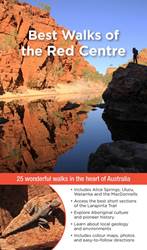
Item #: 9781925403855 -
The heart of Australia contains a wealth of treasures: red-walled gorges, idyllic waterholes, fascinating formations and the culture of people who have inhabited this landscape for many millennia. It is a diverse landscape of arid flatlands, striped with ancient ranges and hidden, lush gullies. The best way to discover this colourful natural beauty is on foot. Best Walks of the Red Centre, part of Woodslane’s popular walking guides series which has sold over 100,000 copies, introduces...
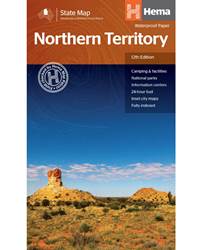
Item #: 9781925625684 -
A map of the Northern Territory that has camping and rest areas, 24hour fuel and points of interest marked on the mapping. On the reverse are CBD maps of Darwin and Alice Springs, a map of the greater Darwin region and maps of Yulara, Uluru and Kata Tjuta with walking tracks, points of interest and accommodation included. For trip planning there is a national park matrix and contact details for information centres. PRODUCT FEATURES GPS surveyed roads and tracksFuel stops4WD tracksCamping...
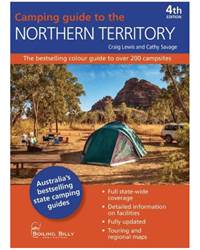
Item #: 9781925403879 -
This 4th Edition of Camping Guide to the Northern Territory has been fully revised and updated. Camping Guide to the Northern Territory details over 200 campsites throughout the Territories 71 national parks, conservation areas and reserves where you can pitch your tent on public land for free over very little cost. Whether you prefer the conveniences of an established campground in Kakadu, prefer to hike or walk- in to your secluded campsite along the Larapinta Trail or drive your four-wheel...
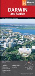
Item #: 9781865006338 -
Hema's Darwin and Region Map features Darwin city (1:25,000) and suburbs on one side and maps of Palmerston (1:25,000), Howard Springs to Humpty Doo (1:75:000) and the Darwin region on the reverse. Features: CBD map Regional map Postcodes 24-hour fuel Caravan parks Points of interest Fully indexedFolded size (WxHxD): 116mm X 250mm x 3mm Flat size (WxH): 700mm X 1000mm ...